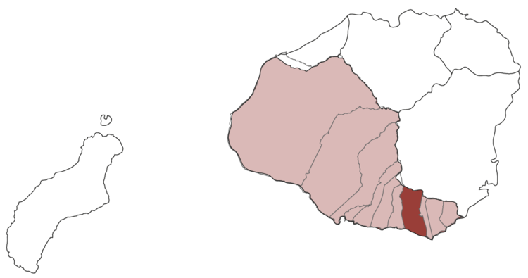
The eastern boundary point was near today's Poipu Beach Park. On the west, the boundary point with Lāwa‘i was at Kukui-‘ula.


An ahupua‘a of the Kona district.
Kōloa was an ahupua‘a, one of the fifty-four land divisions of ancient days. It belonged to the Kona district. The ahupua‘a started at the top of Kahili, a peak of 3089 feet.
Along the shore the eastern boundary point between Koloa and Weliweli was near today's Poipu Beach Park. On the west, the boundary point with Lāwa‘i was at Kukui-‘ula.
There are three possible meanings of its name.
First, the land may have been named after the native duck (Anas wuvilliana wyvilliana) that lived in the large lake Ka-lua-honu and in the marshes that covered much of the western area of this land. The koloa was not a migratory bird unlike the migratory ducks, koloa-mapu, the pin-tail duck, and the koloa-moha, the shoveler or spoonbill duck. There was also a now extinct three-foot high flightless duck that lived here whose skeletons have been found by archaeologists.
Second, it is sometimes said that the ahupua‘a took its name from a steep rock on the east bank of Maulili pond in Waikomo stream, named Pali-o-Koloa, Cliff of Koloa, but there is no indication of who or what Koloa was.
Third, it may mean Long sugar cane. Sugar cane was brought by the earliest settlers and planted in their gardens as a source of sugar. Sometimes the leaves were used for thatching houses. The Hawaiians had names for at least 40 varieties of sugar cane. The largest kō-loa grew up to 30 feet in height. The most common cane was a soft and large sized one.
It was perhaps no accident that the first sugar plantation was established at Koloa.
Aie o Koloa
Is at Koloa
A play on ko (drawn) and loa (long), drawn a long way under. Drunk. [Hyde]
nā iliili o Kōloa
the pebbles of Kōloa [Hyde]